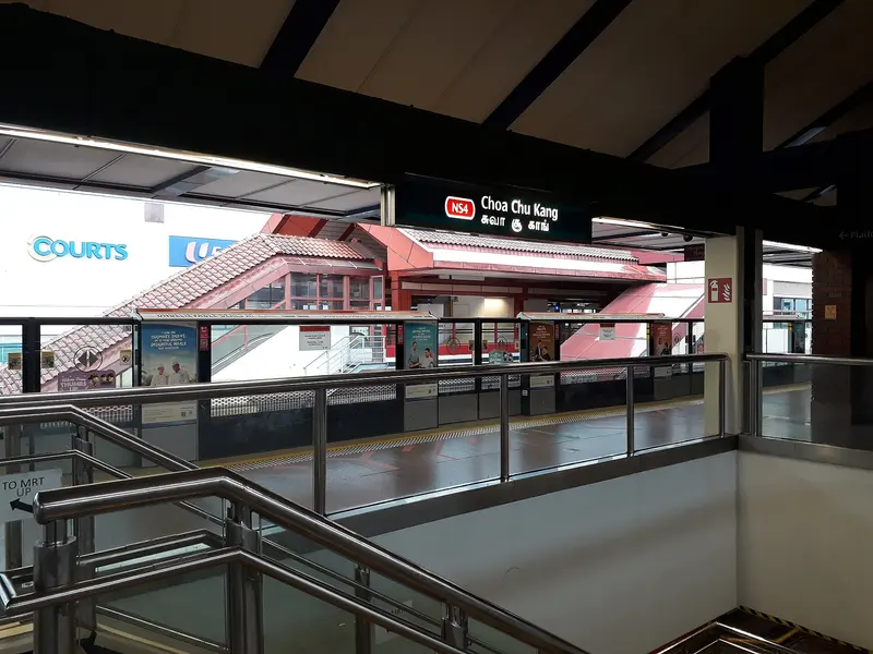
Which exit?
See on map-
KFC · 16 m
- KFC
- Ya Kun Kaya Toast
- MOS Burger
- Surhiro スシロー
- The Coffee Bean & Tea Leaf
Places in a straight line from this exit: LTA’s bus stops, the hotel, pharmacy and money changer registers, and OpenStreetMap’s places to eat. It is not what LTA’s signs say.
Show this exit in Google Maps -
Bus stop Opp Choa Chu Kang Stn · 35 m
- KOI Thé
- Mr Bean
- Opp Choa Chu Kang Stn
- TamJai SamGor Mixian 譚仔三哥米線
- Starbucks
Places in a straight line from this exit: LTA’s bus stops, the hotel, pharmacy and money changer registers, and OpenStreetMap’s places to eat. It is not what LTA’s signs say.
Show this exit in Google Maps -
Choa Chu Kang Park
This exit is the nearest one to these places, in a straight line from the exit. It is not what LTA’s signs say.
Show this exit in Google Maps -
Money changer TRADEX 19 · 34 m
- TRADEX 19
- Nine Spices
- 302 Foodhouse Bak Chor Mee
- CCK 302 Foodhouse
Places in a straight line from this exit: LTA’s bus stops, the hotel, pharmacy and money changer registers, and OpenStreetMap’s places to eat. It is not what LTA’s signs say.
Show this exit in Google Maps
4 exits · 4 with a map position · exits and positions: LTA
Right now at this station
Train service, lifts and crowds: LTA DataMall, live. Weather: NEA two-hour forecast (data.gov.sg), for the forecast area nearest the station.

Buses at the exits
Opp Choa Chu Kang Stn
- 307 to Choa Chu Kang Int…
- 307T to Choa Chu Kang Int…
- 974 to Joo Koon Int…
- 974A to Lot 1/Choa Chu Kang Stn…
- 975 to Bt Panjang Int…
- 975A to Aft Hai Inn See Tp…
All 8 services
- 975B to Opp Lim Chu Kang Lane 3…
- 975C to Police Coast Guard…
Lot 1/Choa Chu Kang Stn
- 172 to Boon Lay Int…
- 190 to Kampong Bahru Ter…
- 190A to Dhoby Ghaut Stn…
- 307 to Choa Chu Kang Int…
- 307A to Opp Choa Chu Kang Stn…
- 974 to Joo Koon Int…
All 10 services
- 975 to Bt Panjang Int…
- 985 to Lor 1 Geylang Ter…
- 991 to Bt Batok Int…
- 991B to Opp Choa Chu Kang Mkt…
Choa Chu Kang Int
- 67 to Tampines Int…
- 172 to Boon Lay Int…
- 188 to HarbourFront Int…
- 188e to HarbourFront IntExpress…
- 190 to Kampong Bahru Ter…
- 190A to Dhoby Ghaut Stn…
All 13 services
- 307A to Opp Choa Chu Kang Stn…
- 925 to Woodlands Temp Int…
- 976 to Bt Panjang Int…
- 983A to Blk 26…
- 985 to Lor 1 Geylang Ter…
- 991 to Bt Batok Int…
- 991B to Opp Choa Chu Kang Mkt…
Express services cost more: bus fares.
LTA DataMall Bus Stops and Bus Routes (read 2026-10-02) and Bus Arrival, Singapore Open Data Licence. Stops within 150 m of an exit, in a straight line. Arrival times are LTA's estimates; first and last buses are LTA's timetable for the stop.
Pharmacies, money changers and hotels
Up to three of each within 400 m of an exit, nearest first, in a straight line. From the registers of HSA (pharmacies), MAS (money changers) and the Hotels Licensing Board, Singapore Open Data Licence. No hours, rates or prices: the registers carry none.
When it’s busy
Busiest from 18:00 to 19:00 on weekdays and from 18:00 to 19:00 on weekends and public holidays.
22nd of 184 stations by taps in August 2026Taps in and out at this station's fare gates in each hour of August 2026, from LTA DataMall (Singapore Open Data Licence). Each row is drawn against its own busiest hour; the darker bar is now. LTA counts Choa Chu Kang LRT Station and this station as one.
Within 800 m in a straight line from the station, not walking routes.
Places to eat near the exits
- KFC
- KOI Thé
- Mr Bean
- Ya Kun Kaya Toast
- MOS Burger
- Surhiro スシロー
- The Coffee Bean & Tea Leaf
- McDonald's
- Food Junction
- Subway
- Dian Xiao Er 店小二
- Yakiniku Shokudo 焼肉食堂
The 12 closest of 18 within 300 m of an exit, nearest first, in a straight line. Not a ranking, and hours are not shown: check before you go. · © OpenStreetMap contributors (ODbL), data as of 6 May 2026
Nearby stations
- Choa Chu Kang LRT Station 40 m
- South View Station 550 m
- Keat Hong Station 900 m
- Teck Whye Station 1.4 km
- Yew Tee Station 1.4 km
- Phoenix Station 1.7 km
Distances are in a straight line from this station, not walking routes.