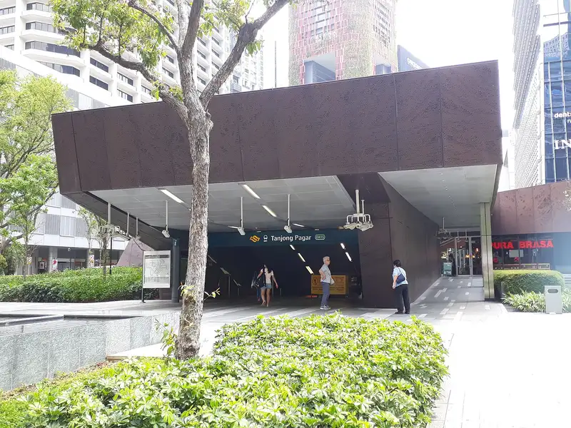
Which exit?
See on map-
Tanjong Pagar Plaza Blk 6 (Blk 6 Tanjong Pagar Plaza Market and Food Centre)
This exit is the nearest one to these places, in a straight line from the exit. It is not what LTA’s signs say.
Show this exit in Google Maps -
Tanjong Pagar Park
This exit is the nearest one to these places, in a straight line from the exit. It is not what LTA’s signs say.
Show this exit in Google Maps -
Keisuke · 25 m
- Keisuke
- Siam Sensation
- The Wicked Garlic
- Jewel 7
- The Coffee Bean & Tea Leaf
Places in a straight line from this exit: LTA’s bus stops, the hotel, pharmacy and money changer registers, and OpenStreetMap’s places to eat. It is not what LTA’s signs say.
Show this exit in Google Maps -
Near Tanjong Pagar Park · 58 m
- Tanjong Pagar Park
- Tanjong Pagar Stn Exit C
- Keisuke
Places in a straight line from this exit: LTA’s bus stops, the hotel, pharmacy and money changer registers, and OpenStreetMap’s places to eat. It is not what LTA’s signs say.
Show this exit in Google Maps -
Fun Toast · 106 m
- Fun Toast
- VENUE by Sebastian
- Aft Straits Blvd
- Monster Curry
- Express
Places in a straight line from this exit: LTA’s bus stops, the hotel, pharmacy and money changer registers, and OpenStreetMap’s places to eat. It is not what LTA’s signs say.
Show this exit in Google Maps -
Custom House, Maxwell Road
This exit is the nearest one to these places, in a straight line from the exit. It is not what LTA’s signs say.
Show this exit in Google Maps -
Telok Ayer Chinese Methodist Church · Amoy Street Food Centre (Telok Ayer Food Centre)
This exit is the nearest one to these places, in a straight line from the exit. It is not what LTA’s signs say.
Show this exit in Google Maps -
Bus stop Tanjong Pagar Stn Exit C · 31 m
- Tanjong Pagar Stn Exit C
- The Palace
- Trung Nguyen Coffee
- Miss Tea
- McDonald's
Places in a straight line from this exit: LTA’s bus stops, the hotel, pharmacy and money changer registers, and OpenStreetMap’s places to eat. It is not what LTA’s signs say.
Show this exit in Google Maps -
Takada · 8 m
- Takada
- Japan Rail Cafe
- French Premium Mountain Cheese
- Cheflam’s Sichuan Cuisine
- Dusk x Dawn
Places in a straight line from this exit: LTA’s bus stops, the hotel, pharmacy and money changer registers, and OpenStreetMap’s places to eat. It is not what LTA’s signs say.
Show this exit in Google Maps
9 exits · 9 with a map position · exits and positions: LTA
Right now at this station
Train service, lifts and crowds: LTA DataMall, live. Weather: NEA two-hour forecast (data.gov.sg), for the forecast area nearest the station.

Taxi stands near the exits
- Shenton Way outside MAS Building Taxi stop · barrier-free
- Cecil St outside GB Building (before McCallum St) Taxi stop · barrier-free
- Robinson Rd before McCallum Street outside Singapore Post Taxi stop · barrier-free
- Tanjong Pagar Rd at Tanjong Pagar Plaza Taxi stand · barrier-free
LTA DataMall Taxi Stands (Singapore Open Data Licence): stand or stop and barrier-free as LTA lists them. Distances are in a straight line from the exit.
Buses at the exits
Tanjong Pagar Stn Exit C
- 57 to Bishan Int…
- 131 to St. Michael's Ter…
- 167 to Sembawang Int…
- 186 to St. Michael's Ter…
- 400 to Shenton Way Ter…
- 673 to Suntec Twr Two…
All 12 services
- 675 to Suntec Twr Two…
- 676 to Suntec Twr Two…
- 677 to Suntec Twr Two…
- 678 to Suntec Twr Two…
- 679 to Suntec Twr Two…
- 970 to Bt Panjang Int…
Aft Straits Blvd
- 10 to Kent Ridge Ter…
- 57 to Bt Merah Int…
- 97 to Tengah Int…
- 97e to Tengah IntExpress…
- 100 to Ghim Moh Ter…
- 131 to Bt Merah Int…
All 17 services
- 502 to Soon Lee Bus PkExpress…
- 647 to Opp Blk 347…
- 649 to Blk 489A…
- 673 to Bef Punggol Pt Stn…
- 674 to Blk 321…
- 675 to Opp Blk 953…
- 676 to Opp Blk 477A…
- 677 to Blk 111…
- 678 to Blk 649…
- 679 to Blk 471A…
- 684 to Blk 816B…
Aft Capital Twr
- 10 to Tampines Int…
- 10e to Man Fatt Lam TpExpress…
- 70 to Yio Chu Kang Int…
- 97 to Promenade Stn/Pan Pacific…
- 97e to Promenade Stn/Pan PacificExpress…
- 100 to Serangoon Int…
All 37 services
- 106 to Bt Batok Int…
- 107 to Hougang Ctrl Int…
- 130 to Ang Mo Kio Int…
- 133 to Ang Mo Kio Int…
- 196 to Bedok Int…
- 196e to Hua Xin CtExpress…
- 646 to Blk 662B…
- 647 to Aft Promenade Stn Exit C…
- 648 to Blk 816…
- 649 to Marina Bay Financial Ctr…
- 650 to Blk 456…
- 651 to Marina Bay Financial Ctr…
- 652 to Bef Sembawang Hills FC…
- 653 to Marina Bay Financial Ctr…
- 654 to Opp Treasure Crest…
- 655 to Marina Bay Financial Ctr…
- 656 to Blk 508 CP…
- 657 to Marina Bay Financial Ctr…
- 660 to Blk 969…
- 660M to Opp Blk 991A…
- 661 to Marina Bay Financial Ctr…
- 663 to Opp Blk 406…
- 665 to Blk 203Express…
- 666 to Promenade Stn/Pan Pacific…
- 667 to Marina Bay Financial Ctr…
- 668 to Marina Bay Financial Ctr…
- 670 to Marina Bay Financial Ctr…
- 671 to Promenade Stn/Pan Pacific…
- 672 to Promenade Stn/Pan Pacific…
- 674 to Marina Bay Financial Ctr…
- 684 to Marina Bay Financial Ctr…
Express services cost more: bus fares.
LTA DataMall Bus Stops and Bus Routes (read 2026-10-02) and Bus Arrival, Singapore Open Data Licence. Stops within 150 m of an exit, in a straight line. Arrival times are LTA's estimates; first and last buses are LTA's timetable for the stop.
Pharmacies, money changers and hotels
- Watson's Personal Care Stores Pte Ltd (International Plaza) Pharmacy
- UNITY By FairPrice (TGP) Pharmacy
- JONG HAP SERVICES & TRADING AGENCY Money changer
- MUSFIRAH TRADING Money changer
- VICTORIA GLORY PTE. LTD. Money changer
- Sofitel Singapore City Centre Hotel · 223 rooms
- Oasia Hotel Downtown, Singapore Hotel · 314 rooms
- Orchid Hotel Hotel · 272 rooms
Up to three of each within 400 m of an exit, nearest first, in a straight line. From the registers of HSA (pharmacies), MAS (money changers) and the Hotels Licensing Board, Singapore Open Data Licence. No hours, rates or prices: the registers carry none.
When it’s busy
Busiest from 18:00 to 19:00 on weekdays and from 12:00 to 13:00 on weekends and public holidays.
27th of 184 stations by taps in August 2026Taps in and out at this station's fare gates in each hour of August 2026, from LTA DataMall (Singapore Open Data Licence). Each row is drawn against its own busiest hour; the darker bar is now.
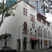 Telok Ayer Chinese Methodist ChurchChurch · 238 m, nearest exit G
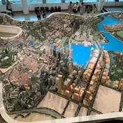 Singapore City GalleryMuseum · 329 m
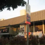 Singapore Conference HallTheatre and venue · 337 mSingapore PolytechnicHistoric site · 365 mAnglo-Chinese SchoolHistoric site · 400 m
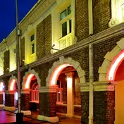 Jinrikisha StationHistoric site · 436 m
Within 800 m in a straight line from the station, not walking routes.
Hawker centres nearest this station
- Amoy Street Food Centre Michelin Bib Gourmand: A Noodle Story, Han Kee, Hoo Kee Bak Chang, J2 Famous Crispy Curry Puff
- Blk 6 Tanjong Pagar Plaza Market and Food Centre
Closures from NEA (data.gov.sg). Stall hours are each stall’s own. Distances are in a straight line from the exit.
Places to eat near the exits
- Takada
- French Premium Mountain Cheese
- Japan Rail Cafe
- Keisuke
- Siam Sensation
- The Wicked Garlic
- Jewel 7
- Cheflam’s Sichuan Cuisine
- The Coffee Bean & Tea Leaf
- Dusk x Dawn
- Fun Toast
- Makan & Sip
The 12 closest of 263 within 300 m of an exit, nearest first, in a straight line. Not a ranking, and hours are not shown: check before you go. Hawker centres are listed above, from NEA. · © OpenStreetMap contributors (ODbL), data as of 6 May 2026
Nearby stations
- Prince Edward Road Station 410 m
- Maxwell Station 500 m
- Shenton Way Station 510 m
- Telok Ayer Station 690 m
- Downtown Station 830 m
- Chinatown Station 910 m
Distances are in a straight line from this station, not walking routes.