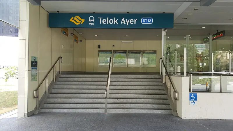
Which exit?
See on map-
Former Nagore Dargah · Former Keng Teck Whay Building +5
- Former Nagore Dargah
- Former Keng Teck Whay Building
- Thian Hock Keng
- Al-Abrar Mosque
- Yeung Ching School
- Pondok Peranakan Gelam Club
- Anglo-Chinese School
This exit is the nearest one to these places, in a straight line from the exit. It is not what LTA’s signs say.
Show this exit in Google Maps -
Ying Fo Fui Kun · Fuk Tak Chi +1
This exit is the nearest one to these places, in a straight line from the exit. It is not what LTA’s signs say.
Show this exit in Google Maps -
Taxi stand Cross St outside Telok Ayer DTL Station · 41 m
- Toast Box
- Starbucks
- Prudential Twr
- Artemis restaurant (40th floor)
- Grain Traders
Places in a straight line from this exit: LTA’s bus stops, the hotel, pharmacy and money changer registers, and OpenStreetMap’s places to eat. It is not what LTA’s signs say.
Show this exit in Google Maps
3 exits · 3 with a map position · exits and positions: LTA
Right now at this station
Train service, lifts and crowds: LTA DataMall, live. Weather: NEA two-hour forecast (data.gov.sg), for the forecast area nearest the station.

Taxi stands near the exits
- Telok Ayer St outside PWC Building Taxi stand · barrier-free
- Cross St outside Telok Ayer DTL Station Taxi stand · barrier-free
- Cecil St outside CapitaGreen Taxi stop · barrier-free
- Amoy St behind Thian Hock Keng Temple Taxi stand
LTA DataMall Taxi Stands (Singapore Open Data Licence): stand or stop and barrier-free as LTA lists them. Distances are in a straight line from the exit.
Buses at the exits
Telok Ayer Stn Exit A
- 186 to St. Michael's Ter…
- 970 to Bt Panjang Int…
Prudential Twr
- 57 to Bishan Int…
- 131 to St. Michael's Ter…
- 167 to Sembawang Int…
LTA DataMall Bus Stops and Bus Routes (read 2026-10-02) and Bus Arrival, Singapore Open Data Licence. Stops within 150 m of an exit, in a straight line. Arrival times are LTA's estimates; first and last buses are LTA's timetable for the stop.
Pharmacies, money changers and hotels
- Guardian Pharmacy (Raffles Place MRT 3) Pharmacy
- SAIF MONEY CHANGER Money changer
- PHOENIX 35 PTE. LTD. Money changer
- AMK COLLECTIONS Money changer
- The Clan Hotel Hotel · 324 rooms
- Amoy Hotel Hotel · 37 rooms
- QT Singapore Hotel · 134 rooms
Up to three of each within 400 m of an exit, nearest first, in a straight line. From the registers of HSA (pharmacies), MAS (money changers) and the Hotels Licensing Board, Singapore Open Data Licence. No hours, rates or prices: the registers carry none.
When it’s busy
Busiest from 18:00 to 19:00 on weekdays and from 12:00 to 13:00 on weekends and public holidays.
72nd of 184 stations by taps in August 2026Taps in and out at this station's fare gates in each hour of August 2026, from LTA DataMall (Singapore Open Data Licence). Each row is drawn against its own busiest hour; the darker bar is now.
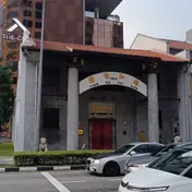 Ying Fo Fui KunArchitecture · 28 m, nearest exit BChui Eng Free SchoolHistoric site · 86 m, nearest exit B
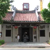 Fuk Tak ChiMuseum · 98 m, nearest exit B
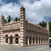 Former Nagore DargahMosque · 111 m, nearest exit AFormer Keng Teck Whay BuildingHistoric site · 141 m, nearest exit A
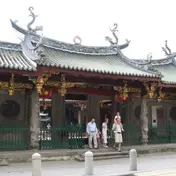 Thian Hock KengTemple · 162 m, nearest exit A
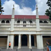 Al-Abrar MosqueMosque · 239 m, nearest exit AYeung Ching SchoolHistoric site · 241 m, nearest exit A
Within 800 m in a straight line from the station, not walking routes.
Places to eat near the exits
- Toast Box
- Ikkoten Omakase
- Marukyu
- Teiyoshita
- Kura Oyster & Highball Bar
- The Jungle Boy
- Baekjung
- L'Operetta Corner Bar
- Dal-In Korean BBQ Restaurant
- Plain vanilla
- Sarnie's Cafe
- 51 Soho
The 12 closest of 210 within 300 m of an exit, nearest first, in a straight line. Not a ranking, and hours are not shown: check before you go. · © OpenStreetMap contributors (ODbL), data as of 6 May 2026
Nearby stations
- Raffles Place Station 400 m
- Maxwell Station 550 m
- Shenton Way Station 570 m
- Chinatown Station 580 m
- Downtown Station 600 m
- Tanjong Pagar Station 690 m
Distances are in a straight line from this station, not walking routes.