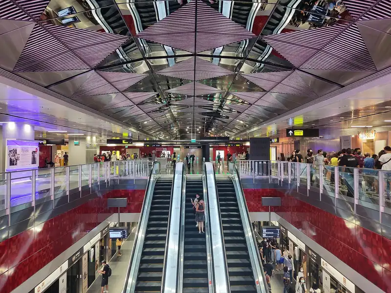
Which exit?
See on map-
Far East Plaza · Goodwood Park Hotel (Tower Block)
This exit is the nearest one to these places, in a straight line from the exit. It is not what LTA’s signs say.
Show this exit in Google Maps -
Bus stop Orchard Stn/Tang Plaza · 38 m
- Orchard Stn/Tang Plaza
Places in a straight line from this exit: LTA’s bus stops, the hotel, pharmacy and money changer registers, and OpenStreetMap’s places to eat. It is not what LTA’s signs say.
Show this exit in Google Maps -
Lucky Plaza · Ngee Ann City +1
This exit is the nearest one to these places, in a straight line from the exit. It is not what LTA’s signs say.
Show this exit in Google Maps -
ION Orchard
This exit is the nearest one to these places, in a straight line from the exit. It is not what LTA’s signs say.
Show this exit in Google Maps -
Food Opera · 20 m
- Food Opera
- Ya Kun Kaya Toast
- Boost Juice Bar
- Toast Box
- 4Fingers Crispy Chicken
Places in a straight line from this exit: LTA’s bus stops, the hotel, pharmacy and money changer registers, and OpenStreetMap’s places to eat. It is not what LTA’s signs say.
Show this exit in Google Maps -
Taxi stand Orchard Turn at Wisma Atria Shopping Centre · 47 m
- Popeyes
Places in a straight line from this exit: LTA’s bus stops, the hotel, pharmacy and money changer registers, and OpenStreetMap’s places to eat. It is not what LTA’s signs say.
Show this exit in Google Maps -
Bus stop Opp Orchard Stn/ION · 42 m
- Opp Orchard Stn/ION
Places in a straight line from this exit: LTA’s bus stops, the hotel, pharmacy and money changer registers, and OpenStreetMap’s places to eat. It is not what LTA’s signs say.
Show this exit in Google Maps -
Near ION Orchard · 113 m
- ION Orchard
- Opp Orchard Stn/ION
- Ya Kun Kaya Toast
Places in a straight line from this exit: LTA’s bus stops, the hotel, pharmacy and money changer registers, and OpenStreetMap’s places to eat. It is not what LTA’s signs say.
Show this exit in Google Maps -
Near ION Orchard · 102 m
- ION Orchard
- Toast Box
- Ya Kun Kaya Toast
Places in a straight line from this exit: LTA’s bus stops, the hotel, pharmacy and money changer registers, and OpenStreetMap’s places to eat. It is not what LTA’s signs say.
Show this exit in Google Maps -
Guardian Pharmacy (ION) · 30 m
- Guardian Pharmacy (ION)
- Watson's Personal Care Stores Pte Ltd Ion Orchard
- Starbucks
- Cedele
- Starbucks
Places in a straight line from this exit: LTA’s bus stops, the hotel, pharmacy and money changer registers, and OpenStreetMap’s places to eat. It is not what LTA’s signs say.
Show this exit in Google Maps -
Délifrance · 38 m
- Délifrance
- Uya
- M&S Café
- Shake Shack
- Harry's
Places in a straight line from this exit: LTA’s bus stops, the hotel, pharmacy and money changer registers, and OpenStreetMap’s places to eat. It is not what LTA’s signs say.
Show this exit in Google Maps -
Bus stop Opp Orchard Stn Exit 12 · 107 m
- Opp Orchard Stn Exit 12
- Aft Orchard Stn Exit 12
Places in a straight line from this exit: LTA’s bus stops, the hotel, pharmacy and money changer registers, and OpenStreetMap’s places to eat. It is not what LTA’s signs say.
Show this exit in Google Maps -
Bus stop Orchard Stn Exit 13 · 40 m
- Orchard Stn Exit 13
Places in a straight line from this exit: LTA’s bus stops, the hotel, pharmacy and money changer registers, and OpenStreetMap’s places to eat. It is not what LTA’s signs say.
Show this exit in Google Maps
13 exits · 13 with a map position · exits and positions: LTA
Right now at this station
Train service, lifts and crowds: LTA DataMall, live. Weather: NEA two-hour forecast (data.gov.sg), for the forecast area nearest the station.

Taxi stands near the exits
- Orchard Turn at Wisma Atria Shopping Centre Taxi stand · barrier-free
- Orchard Boulevard outside Orchard TEL Station (Ent 13) Taxi stand · barrier-free
- Orchard Rd along driveway of Lucky Plaza Taxi stand · barrier-free
- Mt Elizabeth Rd at Mt Elizabeth Hospital Taxi stand · barrier-free
LTA DataMall Taxi Stands (Singapore Open Data Licence): stand or stop and barrier-free as LTA lists them. Distances are in a straight line from the exit.
Smoking areas near the exits
- Wheelock Place Back of the building
- Lucky Plaza Side of the building
- Shaw House Front of the building
- Tang Plaza Side of the building
Orchard Road is a No Smoking Zone: there, smoking is allowed only in these areas.
Orchard Road is a No Smoking Zone: there, smoking is allowed only in the areas NEA designates. NEA's list (data.gov.sg, Singapore Open Data Licence); distances are in a straight line from the exit. All of them
Buses at the exits
Orchard Stn/Tang Plaza
- 36 to Changi Airport Ter 2…
- 36B to Bef Seaside Residences…
- 77 to Promenade Stn/Pan Pacific…
- 124 to HarbourFront Int…
- 143 to Jurong East Int…
- 167 to Bt Merah Int…
All 15 services
- 174 to Kampong Bahru Ter…
- 174e to Kampong Bahru TerExpress…
- 190 to Kampong Bahru Ter…
- 190A to Dhoby Ghaut Stn…
- 518 to Pasir Ris IntExpress…
- 518A to Bayfront Stn Exit AExpress…
- 972 to Bt Panjang Int…
- 972A to Dhoby Ghaut Stn…
- 972M to Bt Panjang Int…
Orchard Stn Exit 13
- 7 to Clementi Int…
- 14 to Clementi Int…
- 16 to Bt Merah Int…
- 16M to Bt Merah Int…
- 36 to Changi Airport Ter 2…
- 36A to Aft Cuscaden Rd…
All 15 services
- 36B to Bef Seaside Residences…
- 65 to HarbourFront Int…
- 77 to Bt Batok Int…
- 106 to Bt Batok Int…
- 111 to Ghim Moh Ter…
- 123 to Bt Merah Int…
- 174 to Boon Lay Int…
- 174e to Boon Lay IntExpress…
- 175 to Clementi Int…
Opp Orchard Stn/ION
- 14e to Orchard Stn/Lucky PlazaExpress…
- 124 to St. Michael's Ter…
- 143 to Toa Payoh Int…
- 167 to Sembawang Int…
- 190 to Choa Chu Kang Int…
- 680 to Opp Blk 991A…
All 11 services
- 681 to Revival Ctr Ch…
- 682 to Opp Blk 204 CP…
- 683 to Revival Ctr Ch…
- 972 to Bt Panjang Int…
- 972M to Bt Panjang Int…
Opp Orchard Stn Exit 12
- 5 to Pasir Ris Int…
- 14 to Bedok Int…
- 16 to Bedok Int…
- 16M to Bedok Int…
- 54 to Bishan Int…
- 65 to Tampines Int…
All 7 services
- 175 to Lor 1 Geylang Ter…
Express services cost more: bus fares.
LTA DataMall Bus Stops and Bus Routes (read 2026-10-02) and Bus Arrival, Singapore Open Data Licence. Stops within 150 m of an exit, in a straight line. Arrival times are LTA's estimates; first and last buses are LTA's timetable for the stop.
Pharmacies, money changers and hotels
- Watson's Personal Care Stores Pte Ltd Ion Orchard Pharmacy
- Guardian Pharmacy (ION) Pharmacy
- Trident Pharm Pte Ltd Pharmacy
- FAJAR STORE Money changer
- SAPPHIRE EXCHANGE Money changer
- RADS EXCHANGE PTE. LTD. Money changer
- Singapore Marriott Tang Plaza Hotel Hotel · 403 rooms
- Grand Hyatt Singapore Hotel · 699 rooms
- YOTEL Singapore Orchard Road Hotel · 610 rooms
Up to three of each within 400 m of an exit, nearest first, in a straight line. From the registers of HSA (pharmacies), MAS (money changers) and the Hotels Licensing Board, Singapore Open Data Licence. No hours, rates or prices: the registers carry none.
When it’s busy
Busiest from 18:00 to 19:00 on weekdays and from 16:00 to 17:00 on weekends and public holidays.
2nd of 184 stations by taps in August 2026Taps in and out at this station's fare gates in each hour of August 2026, from LTA DataMall (Singapore Open Data Licence). Each row is drawn against its own busiest hour; the darker bar is now.
 ION OrchardShopping centre · 61 m, nearest exit 4
 Lucky PlazaShopping centre · 207 m, nearest exit 3
 Ngee Ann CityShopping centre · 236 m, nearest exit 3
 The ParagonShopping centre · 309 m, nearest exit 3
 Far East PlazaShopping centre · 345 m, nearest exit 1
 Masjid Al-FalahMosque · 497 m
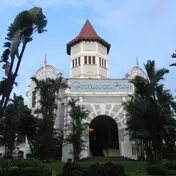 Goodwood Park Hotel (Tower Block)Historic site · 511 m, nearest exit 1Singapore Chinese Girls' SchoolHistoric site · 777 m
Within 800 m in a straight line from the station, not walking routes.
Places to eat near the exits
- The Coffee Bean & Tea Leaf
- Popeyes
- Food Opera
- The Coffee Bean & Tea Leaf
- Ya Kun Kaya Toast
- Paradise Dynasty
- Food Republic
- Ya Kun Kaya Toast
- Boost Juice Bar
- Saladstop!
- Toast Box
- Fun Toast
The 12 closest of 118 within 300 m of an exit, nearest first, in a straight line. Not a ranking, and hours are not shown: check before you go. · © OpenStreetMap contributors (ODbL), data as of 6 May 2026
Nearby stations
- Somerset Station 870 m
- Orchard Boulevard Station 970 m
- Great World Station 1.0 km
- Newton Station 1.1 km
- Napier Station 1.5 km
- Dhoby Ghaut Station 1.7 km
Distances are in a straight line from this station, not walking routes.