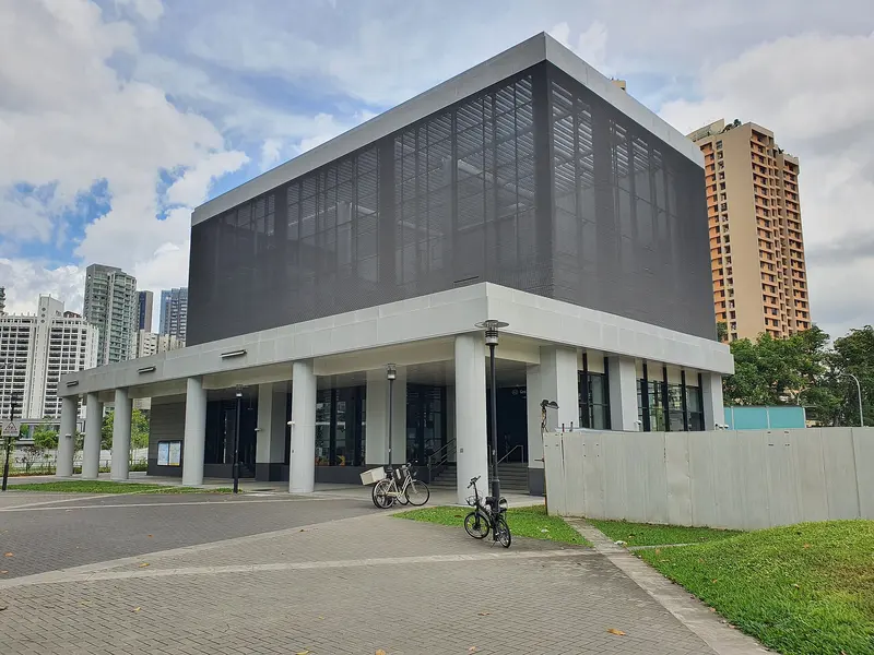
Which exit?
See on map-
Jiak Kim Bridge · Wetterling Teo Gallery
This exit is the nearest one to these places, in a straight line from the exit. It is not what LTA’s signs say.
Show this exit in Google Maps -
Kim Seng Bridge · Zion Riverside Food Centre +1
This exit is the nearest one to these places, in a straight line from the exit. It is not what LTA’s signs say.
Show this exit in Google Maps -
McDonald's · 44 m
- McDonald's
- Cedele (Great World City)
- Great World Stn Exit 3
- Guardian Pharmacy (Great World City)
- Watson's Personal Care Stores Pte Ltd (Great World City)
Places in a straight line from this exit: LTA’s bus stops, the hotel, pharmacy and money changer registers, and OpenStreetMap’s places to eat. It is not what LTA’s signs say.
Show this exit in Google Maps -
Bus stop Great World Stn Exit 5 · 38 m
- Great World Stn Exit 5
- La Villa
- Great World Stn Exit 4
Places in a straight line from this exit: LTA’s bus stops, the hotel, pharmacy and money changer registers, and OpenStreetMap’s places to eat. It is not what LTA’s signs say.
Show this exit in Google Maps -
Near Great World Stn Exit 5 · 44 m
- Great World Stn Exit 5
- La Villa
Places in a straight line from this exit: LTA’s bus stops, the hotel, pharmacy and money changer registers, and OpenStreetMap’s places to eat. It is not what LTA’s signs say.
Show this exit in Google Maps -
Near The Gong · 43 m
- The Gong
- Kofx
- McDonald's
Places in a straight line from this exit: LTA’s bus stops, the hotel, pharmacy and money changer registers, and OpenStreetMap’s places to eat. It is not what LTA’s signs say.
Show this exit in Google Maps
6 exits · 6 with a map position · exits and positions: LTA
Right now at this station
Train service, lifts and crowds: LTA DataMall, live. Weather: NEA two-hour forecast (data.gov.sg), for the forecast area nearest the station.

Taxi stands near the exits
- River Valley Green Rd outside Great World TEL Station (Ent 1) Taxi stand · barrier-free
- Havelock Rd outside Havelock TEL Station (Ent 4) Taxi stand · barrier-free
LTA DataMall Taxi Stands (Singapore Open Data Licence): stand or stop and barrier-free as LTA lists them. Distances are in a straight line from the exit.
Buses at the exits
Great World Stn Exit 5
- 32 to Bedok Int…
- 54 to Kampong Bahru Ter…
- 139 to Toa Payoh Int…
- 195 to Promenade Stn/Pan Pacific…
Great World Stn Exit 3
- 5 to Bt Merah Int…
- 16 to Bt Merah Int…
- 16M to Bt Merah Int…
- 75 to Bt Merah Int…
- 175 to Clementi Int…
- 195 to Promenade Stn/Pan Pacific…
All 8 services
- 195A to Tiong Bahru Stn/Plaza…
- 970 to Shenton Way Ter…
Great World Stn Exit 4
- 32 to Buona Vista Ter…
- 54 to Bishan Int…
- 139 to Bt Merah Int…
- 195 to Promenade Stn/Pan Pacific…
- 195A to Tiong Bahru Stn/Plaza…
LTA DataMall Bus Stops and Bus Routes (read 2026-10-02) and Bus Arrival, Singapore Open Data Licence. Stops within 150 m of an exit, in a straight line. Arrival times are LTA's estimates; first and last buses are LTA's timetable for the stop.
Pharmacies, money changers and hotels
- Watson's Personal Care Stores Pte Ltd (Great World City) Pharmacy
- Guardian Pharmacy (Great World City) Pharmacy
- TWO-WAY EXCHANGE Money changer
- Grand Copthorne Waterfront Hotel Singapore Hotel · 573 rooms
Up to three of each within 400 m of an exit, nearest first, in a straight line. From the registers of HSA (pharmacies), MAS (money changers) and the Hotels Licensing Board, Singapore Open Data Licence. No hours, rates or prices: the registers carry none.
When it’s busy
Busiest from 18:00 to 19:00 on weekdays and from 17:00 to 18:00 on weekends and public holidays.
91st of 184 stations by taps in August 2026Taps in and out at this station's fare gates in each hour of August 2026, from LTA DataMall (Singapore Open Data Licence). Each row is drawn against its own busiest hour; the darker bar is now.

 Jiak Kim BridgeBridge · 380 m, nearest exit 1
 Kampong Delta MosqueMosque · 674 mHavelock Road Camp / River Valley Road CampHistoric site · 777 m, nearest exit 2
Within 800 m in a straight line from the station, not walking routes.
Hawker centres nearest this station
Closures from NEA (data.gov.sg). Stall hours are each stall’s own. Distances are in a straight line from the exit.
Places to eat near the exits
- The Gong
- Kofx
- McDonald's
- Cedele (Great World City)
- Jack's Place (Great World City)
- KOI Thé
- Starbucks
- Awfully Chocolate +Cafe
- La Villa
- Din Tai Fung
- Tim Ho Wan 添好運
- Ya Kun Kaya Toast
The 12 closest of 21 within 300 m of an exit, nearest first, in a straight line. Not a ranking, and hours are not shown: check before you go. Hawker centres are listed above, from NEA. · © OpenStreetMap contributors (ODbL), data as of 6 May 2026
Nearby stations
- Havelock Station 760 m
- Somerset Station 860 m
- Orchard Station 1.0 km
- Tiong Bahru Station 1.2 km
- Fort Canning Station 1.2 km
- Orchard Boulevard Station 1.4 km
Distances are in a straight line from this station, not walking routes.