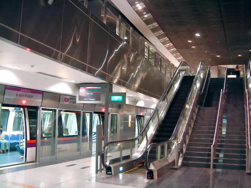
Which exit?
See on map-
Former St James Power Station · Fort Serapong +1
This exit is the nearest one to these places, in a straight line from the exit. It is not what LTA’s signs say.
Show this exit in Google Maps -
Singapore Cable Car · Keppel Bay Bridge +5
- Singapore Cable Car
- Keppel Bay Bridge
- Singapore Oceanarium
- Adventure Cove Waterpark
- MegaZip Adventure Park
- Imbiah Lookout
- Sentosa Luge
This exit is the nearest one to these places, in a straight line from the exit. It is not what LTA’s signs say.
Show this exit in Google Maps -
Masjid Temenggong Daeng Ibrahim · Makam Diraja Johor Telok Blangah
This exit is the nearest one to these places, in a straight line from the exit. It is not what LTA’s signs say.
Show this exit in Google Maps -
Mount Faber · Telok Blangah Rise Blk 36 (Telok Blangah Rise Market) +1
This exit is the nearest one to these places, in a straight line from the exit. It is not what LTA’s signs say.
Show this exit in Google Maps -
VivoCity · Keppel Harbour +1
This exit is the nearest one to these places, in a straight line from the exit. It is not what LTA’s signs say.
Show this exit in Google Maps
5 exits · 5 with a map position · exits and positions: LTA
Right now at this station
Train service, lifts and crowds: LTA DataMall, live. Weather: NEA two-hour forecast (data.gov.sg), for the forecast area nearest the station.

Taxi stands near the exits
- Telok Blangah Rd opposite Harbourfront NEL Station (Ent D) (opp Harbourfront Centre) Taxi stand · barrier-free
LTA DataMall Taxi Stands (Singapore Open Data Licence): stand or stop and barrier-free as LTA lists them. Distances are in a straight line from the exit.
Buses at the exits
HarbourFront Stn/Vivocity
- 10 to Kent Ridge Ter…
- 30 to Boon Lay Int…
- 30e to Opp Heng Mui Keng TerrExpress…
- 57 to Bt Merah Int…
- 61 to Bt Batok Int…
- 65 to HarbourFront Int…
All 16 services
- 80 to HarbourFront Int…
- 97 to Tengah Int…
- 97e to Tengah IntExpress…
- 100 to Ghim Moh Ter…
- 123M to HarbourFront Int…
- 131 to Bt Merah Int…
- 143 to Jurong East Int…
- 145 to Buona Vista Ter…
- 166 to Clementi Int…
- 855 to HarbourFront Int…
Opp VivoCity
- 10 to Tampines Int…
- 30 to Bedok Int…
- 30e to Bedok IntExpress…
- 57 to Bishan Int…
- 61 to Eunos Int…
- 65 to Tampines Int…
All 16 services
- 80 to Compassvale Int…
- 97 to Promenade Stn/Pan Pacific…
- 97e to Promenade Stn/Pan PacificExpress…
- 100 to Serangoon Int…
- 123M to HarbourFront Int…
- 131 to St. Michael's Ter…
- 143 to Toa Payoh Int…
- 145 to Toa Payoh Int…
- 166 to Ang Mo Kio Int…
- 855 to Yishun Int…
HarbourFront Stn Exit A
- 10 to Tampines Int…
- 30 to Bedok Int…
- 30e to Bedok IntExpress…
- 57 to Bishan Int…
- 61 to Eunos Int…
- 65 to Tampines Int…
All 16 services
- 80 to Compassvale Int…
- 97 to Promenade Stn/Pan Pacific…
- 97e to Promenade Stn/Pan PacificExpress…
- 100 to Serangoon Int…
- 123M to HarbourFront Int…
- 131 to St. Michael's Ter…
- 143 to Toa Payoh Int…
- 145 to Toa Payoh Int…
- 166 to Ang Mo Kio Int…
- 855 to Yishun Int…
Express services cost more: bus fares.
LTA DataMall Bus Stops and Bus Routes (read 2026-10-02) and Bus Arrival, Singapore Open Data Licence. Stops within 150 m of an exit, in a straight line. Arrival times are LTA's estimates; first and last buses are LTA's timetable for the stop.
Pharmacies, money changers and hotels
- Watson's Personal Care Stores Pte Ltd (Vivo City) Pharmacy
- Guardian Pharmacy (Vivo) Pharmacy
- Unity By Fairprice (UVVO) Vivo City Pharmacy
- RISING MONEY EXCHANGE PTE. LTD. Money changer
- IAKABA EXCHANGE PTE. LTD. Money changer
- ANUA GROUP MONEY EXCHANGERS PTE. LTD. Money changer
- Travelodge Harbourfront Singapore Hotel · 336 rooms
Up to three of each within 400 m of an exit, nearest first, in a straight line. From the registers of HSA (pharmacies), MAS (money changers) and the Hotels Licensing Board, Singapore Open Data Licence. No hours, rates or prices: the registers carry none.
When it’s busy
Busiest from 18:00 to 19:00 on weekdays and from 17:00 to 18:00 on weekends and public holidays.
9th of 184 stations by taps in August 2026Taps in and out at this station's fare gates in each hour of August 2026, from LTA DataMall (Singapore Open Data Licence). Each row is drawn against its own busiest hour; the darker bar is now.
 VivoCityShopping centre · 175 m, nearest exit EKeppel HarbourHistoric site · 251 m, nearest exit E
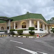 Masjid Temenggong Daeng IbrahimMosque · 329 m, nearest exit C
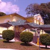 Makam Diraja Johor Telok BlangahHistoric site · 369 m, nearest exit C
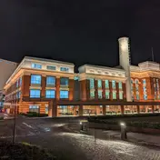 Former St James Power StationHistoric site · 380 m, nearest exit A
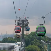 Singapore Cable CarViews and rides · 545 m, nearest exit B
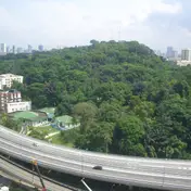 Mount FaberPark and garden · 764 m, nearest exit D
Within 800 m in a straight line from the station, not walking routes.
Hawker centres nearest this station
Closures from NEA (data.gov.sg). Stall hours are each stall’s own. Distances are in a straight line from the exit.
Places to eat near the exits
- McDonald's
- The Coffee Bean & Tea Leaf
- Toast Box
- Central Hong Kong Café
- A One Claypot House
- Jia Xiang Sarawak Kolo Mee
- Mr Bean
- Tiong Bahru Bakery
- Ichiban Boshi
- Ya Kun Kaya Toast
- Heavenly Wang
- The Coffee Bean & Tea Leaf
The 12 closest of 102 within 300 m of an exit, nearest first, in a straight line. Not a ranking, and hours are not shown: check before you go. Hawker centres are listed above, from NEA. · © OpenStreetMap contributors (ODbL), data as of 6 May 2026
Nearby stations
- Keppel Station 1.1 km
- Telok Blangah Station 1.4 km
- Cantonment Station 1.9 km
- Labrador Park Station 2.2 km
- Tiong Bahru Station 2.4 km
- Outram Park Station 2.6 km
Distances are in a straight line from this station, not walking routes.