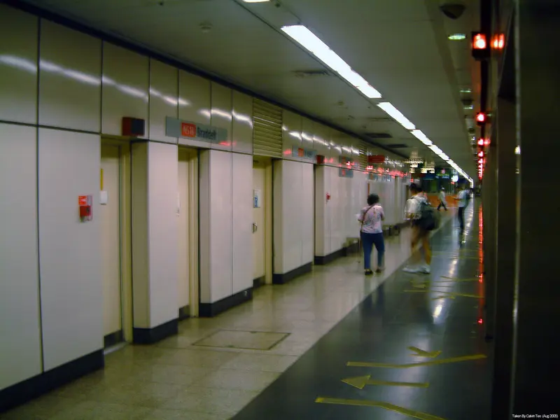
Which exit?
See on map-
Taxi stand Lor 1 Toa Payoh in front of Blk 109 (near Braddell MRT Station) · 42 m
- McDonald's
- Hawker Centre
Places in a straight line from this exit: LTA’s bus stops, the hotel, pharmacy and money changer registers, and OpenStreetMap’s places to eat. It is not what LTA’s signs say.
Show this exit in Google Maps -
Toa Payoh Lorong 1 Blk 127 (Toa Payoh West Market and Food Court)
This exit is the nearest one to these places, in a straight line from the exit. It is not what LTA’s signs say.
Show this exit in Google Maps -
Toa Payoh Lorong 4 Blk 93 · Toa Payoh Lorong 8 Blk 210
This exit is the nearest one to these places, in a straight line from the exit. It is not what LTA’s signs say.
Show this exit in Google Maps
3 exits · 3 with a map position · exits and positions: LTA
Right now at this station
Train service, lifts and crowds: LTA DataMall, live. Weather: NEA two-hour forecast (data.gov.sg), for the forecast area nearest the station.

Taxi stands near the exits
- Lor 1 Toa Payoh in front of Blk 109 (near Braddell MRT Station) Taxi stand · barrier-free
LTA DataMall Taxi Stands (Singapore Open Data Licence): stand or stop and barrier-free as LTA lists them. Distances are in a straight line from the exit.
Buses at the exits
Braddell Stn/Blk 107
- 59 to Bishan Int…
- 129 to Tampines Nth Int…
- 231 to Toa Payoh Int…
- 232 to Toa Payoh Int…
Braddell Stn/Blk 106
- 59 to Changi Village Ter…
- 129 to St. Michael's Ter…
- 231 to Toa Payoh Int…
- 232 to Toa Payoh Int…
Braddell Stn/Blk 111
- 59 to Bishan Int…
- 231 to Toa Payoh Int…
- 235 to Toa Payoh Int…
LTA DataMall Bus Stops and Bus Routes (read 2026-10-02) and Bus Arrival, Singapore Open Data Licence. Stops within 150 m of an exit, in a straight line. Arrival times are LTA's estimates; first and last buses are LTA's timetable for the stop.
When it’s busy
Busiest from 18:00 to 19:00 on weekdays and from 18:00 to 19:00 on weekends and public holidays.
70th of 184 stations by taps in August 2026Taps in and out at this station's fare gates in each hour of August 2026, from LTA DataMall (Singapore Open Data Licence). Each row is drawn against its own busiest hour; the darker bar is now.
Within 800 m in a straight line from the station, not walking routes.
Hawker centres nearest this station
- Toa Payoh Lorong 4 Blk 93
- Toa Payoh West Market and Food Court Michelin Bib Gourmand: Chey Sua Carrot Cake
- Toa Payoh Lorong 8 Blk 210
Closures from NEA (data.gov.sg). Stall hours are each stall’s own. Distances are in a straight line from the exit.
Places to eat near the exits
- Coffee Shiop
- McDonald's
- Spices & Curries Express
- Thailily
- Fo Lau Ping (Popular) Vegetarian
- Hawker Centre
- Tims Restaurant & Cafe
- Toa Payoh Food Centre 2
- Ian-Tau Sarawak Laksa
- Jade's Chicken
- 2612 Little Vietnam Cuisine
- Johnson Eatery
The 12 closest of 12 within 300 m of an exit, nearest first, in a straight line. Not a ranking, and hours are not shown: check before you go. Hawker centres are listed above, from NEA. · © OpenStreetMap contributors (ODbL), data as of 6 May 2026
Nearby stations
- Caldecott Station 860 m
- Toa Payoh Station 870 m
- Bishan Station 1.2 km
- Marymount Station 1.2 km
- Upper Thomson Station 2.2 km
- Novena Station 2.3 km
Distances are in a straight line from this station, not walking routes.