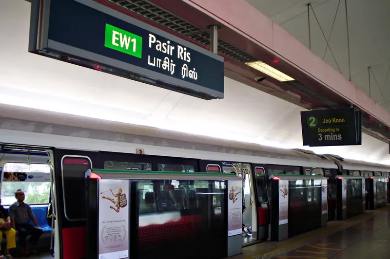
Which exit?
See on map-
Pasir Ris Central Hawker Centre · Pasir Ris Town Park +8
- Pasir Ris Central Hawker Centre
- Pasir Ris Town Park
- NTUC Downtown East
- Wild Wild Wet
- Tampines Eco Green
- Masjid Al-Istighfar
- Loyang Tua Pek Kong temple
- Changi Boardwalk
- Fo Shan Ting Da Bo Gong Temple
- Pulau Ubin
This exit is the nearest one to these places, in a straight line from the exit. It is not what LTA’s signs say.
Show this exit in Google Maps -
Pasir Ris Park
This exit is the nearest one to these places, in a straight line from the exit. It is not what LTA’s signs say.
Show this exit in Google Maps
2 exits · 2 with a map position · exits and positions: LTA
Right now at this station
Train service, lifts and crowds: LTA DataMall, live. Weather: NEA two-hour forecast (data.gov.sg), for the forecast area nearest the station.

Taxi stands near the exits
- Pasir Ris Ctrl St 3 at White Sands Shopping Mall Taxi stand · barrier-free
- Pasir Ris Ctrl outside Pasir Ris MRT Station Taxi stand · barrier-free
LTA DataMall Taxi Stands (Singapore Open Data Licence): stand or stop and barrier-free as LTA lists them. Distances are in a straight line from the exit.
Buses at the exits
Pasir Ris Int/Mall
- 39 to Tampines Concourse Int…
- 53 to Bishan Int…
- 53A to Changi Airport Ter 2…
- 81 to Tampines Int…
- 89 to Hougang Ctrl Int…
- 89A to AirFreight Ter Bldg…
All 9 services
- 109 to Changi Village Ter…
- 518 to Pasir Ris IntExpress…
- 518A to Bayfront Stn Exit AExpress…
Opp Pasir Ris Int/Mall
- 39 to Yishun Int…
- 39A to Aft Piccadilly Circus/TPE…
- 53 to Bishan Int…
- 81 to Tampines Int…
- 89 to Hougang Ctrl Int…
- 109 to Serangoon Int…
All 7 services
- 518 to Pasir Ris IntExpress…
Pasir Ris Int
- 3 to Tampines Int…
- 5 to Bt Merah Int…
- 12 to Kampong Bahru Ter…
- 12e to Kampong Bahru TerExpress…
- 15A to Opp Eunos Stn…
- 17 to Bedok Int…
All 12 services
- 21 to St. Michael's Ter…
- 46 to Upp East Coast Ter…
- 58 to Bishan Int…
- 58B to Aft Tai Seng Stn…
- 88 to Toa Payoh Int…
- 518A to Bayfront Stn Exit AExpress…
Pasir Ris Int/Polyclinic
- 3 to Punggol Int…
- 3A to Blk 747A…
- 46 to Upp East Coast Ter…
- 403 to Pasir Ris Int…
Express services cost more: bus fares.
LTA DataMall Bus Stops and Bus Routes (read 2026-10-02) and Bus Arrival, Singapore Open Data Licence. Stops within 150 m of an exit, in a straight line. Arrival times are LTA's estimates; first and last buses are LTA's timetable for the stop.
Pharmacies, money changers and hotels
- Guardian Pharmacy (White Sands Mall) Pharmacy
- UNITY By FairPrice (UWSA) Pharmacy
- Singhealth Poly - Pasir Ris Pharmacy
- RAHIM TRADERS Money changer
Up to three of each within 400 m of an exit, nearest first, in a straight line. From the registers of HSA (pharmacies), MAS (money changers) and the Hotels Licensing Board, Singapore Open Data Licence. No hours, rates or prices: the registers carry none.
When it’s busy
Busiest from 18:00 to 19:00 on weekdays and from 17:00 to 18:00 on weekends and public holidays.
36th of 184 stations by taps in August 2026Taps in and out at this station's fare gates in each hour of August 2026, from LTA DataMall (Singapore Open Data Licence). Each row is drawn against its own busiest hour; the darker bar is now.
 Pasir Ris Town ParkPark and garden · 350 m, nearest exit A
 NTUC Downtown EastViews and rides · 651 m, nearest exit A
 Wild Wild WetViews and rides · 709 m, nearest exit A
Within 800 m in a straight line from the station, not walking routes.
Hawker centres nearest this station
Closures from NEA (data.gov.sg). Stall hours are each stall’s own. Distances are in a straight line from the exit.
Places to eat near the exits
- 爱茶 i.tea
- Mr Bean
- Old Chang Kee
- Dough Culture
- Jian Bing Lao
- Boost Juice
- 小菜一碟
- Mr Teh Tarik Deli
- Kopi & Tarts
- Pezzo
- Mr. Coconut
- CHICHA San Chen
The 12 closest of 109 within 300 m of an exit, nearest first, in a straight line. Not a ranking, and hours are not shown: check before you go. Hawker centres are listed above, from NEA. · © OpenStreetMap contributors (ODbL), data as of 6 May 2026
Nearby stations
- Tampines East Station 2.0 km
- Tampines Station 2.2 km
- Tampines West Station 3.3 km
- Simei Station 3.3 km
- Upper Changi Station 3.7 km
- Riviera Station 4.4 km
Distances are in a straight line from this station, not walking routes.