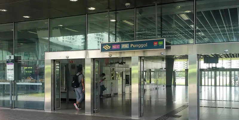
Which exit?
See on map-
Mr Bean · 63 m
- Mr Bean
- Old Chang Kee
- Mr. Coconut
- Wok Hey
- Nam Kee Pau
Places in a straight line from this exit: LTA’s bus stops, the hotel, pharmacy and money changer registers, and OpenStreetMap’s places to eat. It is not what LTA’s signs say.
Show this exit in Google Maps -
Bus stop Punggol Stn/Waterway Pt · 48 m
- Punggol Stn/Waterway Pt
Places in a straight line from this exit: LTA’s bus stops, the hotel, pharmacy and money changer registers, and OpenStreetMap’s places to eat. It is not what LTA’s signs say.
Show this exit in Google Maps -
Tea Tree Cafe · 25 m
- Tea Tree Cafe
- Lao Ban Soya Beancurd
- Uncle's Otah
- NTWU Canteen
- Punggol Int
Places in a straight line from this exit: LTA’s bus stops, the hotel, pharmacy and money changer registers, and OpenStreetMap’s places to eat. It is not what LTA’s signs say.
Show this exit in Google Maps -
Near Punggol Int · 95 m
- Punggol Int
- Punggol Stn/Int
- Tea Tree Cafe
Places in a straight line from this exit: LTA’s bus stops, the hotel, pharmacy and money changer registers, and OpenStreetMap’s places to eat. It is not what LTA’s signs say.
Show this exit in Google Maps
4 exits · 4 with a map position · exits and positions: LTA
Right now at this station
Train service, lifts and crowds: LTA DataMall, live. Weather: NEA two-hour forecast (data.gov.sg), for the forecast area nearest the station.

Taxi stands near the exits
- Punggol Ctrl outside Punggol NEL Station (Ent C) (outside Punggol Bus Interchange) Taxi stand · barrier-free
- Punggol Ctrl at driveway of Waterway Point Taxi stand · barrier-free
LTA DataMall Taxi Stands (Singapore Open Data Licence): stand or stop and barrier-free as LTA lists them. Distances are in a straight line from the exit.
Buses at the exits
Punggol Stn/Waterway Pt
- 34 to Punggol Coast Int…
- 34A to Opp Our Tampines Hub…
- 39 to Tampines Concourse Int…
- 39B to Pasir Ris Int/Mall…
- 44 to Near SATS Flight Kitchen…
- 381 to Punggol Coast Int…
All 7 services
- 459 to Aft Tai Seng Stn…
Punggol Int
- 3 to Tampines Int…
- 43 to Upp East Coast Ter…
- 43A to S'goon Stn Exit C/Blk 201…
- 43e to Marine Pde Stn Exit 4Express…
- 50 to Bishan Int…
- 62A to Aljunied Stn…
All 14 services
- 83T to Sengkang Int…
- 85 to Yishun Int…
- 118 to Changi Business Pk Ter…
- 118A to ITE Coll East Adm Blk…
- 136 to Ang Mo Kio Int…
- 381 to Punggol Coast Int…
- 382A to Blk 226A…
- 386A to Blk 682A…
Punggol Stn/Int
- 34 to Punggol Coast Int…
- 39 to Yishun Int…
- 39A to Aft Piccadilly Circus/TPE…
- 43 to Upp East Coast Ter…
- 43A to S'goon Stn Exit C/Blk 201…
- 43e to Marine Pde Stn Exit 4Express…
All 11 services
- 44 to Punggol Coast Int…
- 118 to Changi Business Pk Ter…
- 118A to ITE Coll East Adm Blk…
- 381 to Punggol Int…
- 384 to Punggol Int…
Express services cost more: bus fares.
LTA DataMall Bus Stops and Bus Routes (read 2026-10-02) and Bus Arrival, Singapore Open Data Licence. Stops within 150 m of an exit, in a straight line. Arrival times are LTA's estimates; first and last buses are LTA's timetable for the stop.
Pharmacies, money changers and hotels
- Guardian Pharmacy ( Waterway Point) Pharmacy
- UNITY By FairPrice (UWWP) Pharmacy
- WATSON'S PERSONAL CARE STORES PTE LTD (WATERWAY POINT) Pharmacy
- PUNGGOL EXCHANGE Money changer
Up to three of each within 400 m of an exit, nearest first, in a straight line. From the registers of HSA (pharmacies), MAS (money changers) and the Hotels Licensing Board, Singapore Open Data Licence. No hours, rates or prices: the registers carry none.
When it’s busy
Busiest from 18:00 to 19:00 on weekdays and from 17:00 to 18:00 on weekends and public holidays.
17th of 184 stations by taps in August 2026Taps in and out at this station's fare gates in each hour of August 2026, from LTA DataMall (Singapore Open Data Licence). Each row is drawn against its own busiest hour; the darker bar is now.
Within 800 m in a straight line from the station, not walking routes.
Places to eat near the exits
- Tea Tree Cafe
- Lao Ban Soya Beancurd
- Uncle's Otah
- NTWU Canteen
- Mr Bean
- Old Chang Kee
- Mr. Coconut
- Wok Hey
- Nam Kee Pau
- Dough Culture
- Warabi-Mochi Kamakura
- Auntie Anne's
The 12 closest of 78 within 300 m of an exit, nearest first, in a straight line. Not a ranking, and hours are not shown: check before you go. · © OpenStreetMap contributors (ODbL), data as of 6 May 2026
Nearby stations
- Sumang Station 560 m
- Sam Kee Station 570 m
- Soo Teck Station 570 m
- Damai Station 680 m
- Cove Station 750 m
- Nibong Station 770 m
Distances are in a straight line from this station, not walking routes.