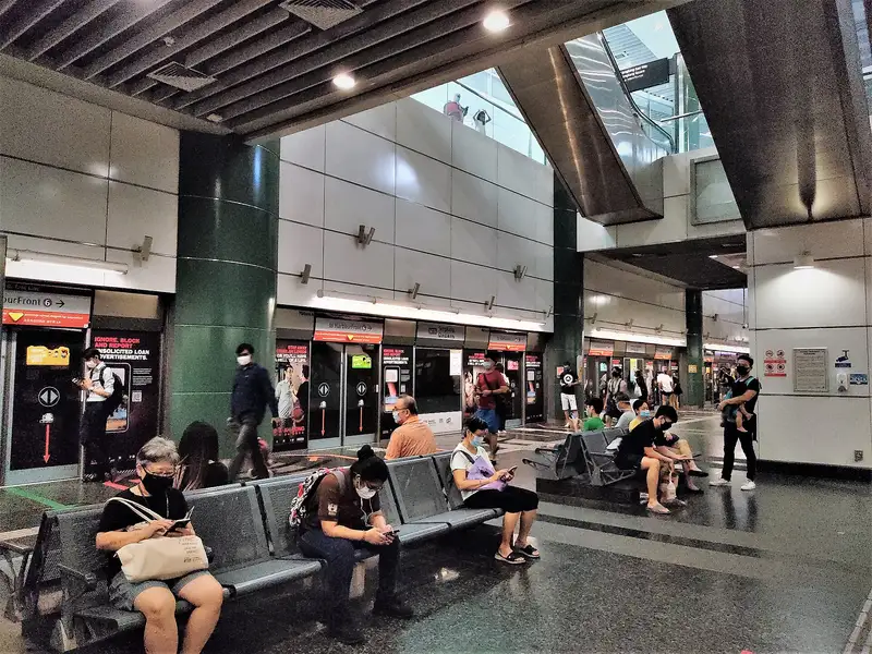
Which exit?
See on map-
Ananas Seng Kang · 12 m
- Ananas Seng Kang
- Lao Ban Soya Beancurd
- The House Of Lemang
- Umi Sushi
- Sally's
Places in a straight line from this exit: LTA’s bus stops, the hotel, pharmacy and money changer registers, and OpenStreetMap’s places to eat. It is not what LTA’s signs say.
Show this exit in Google Maps -
Bus stop Sengkang Int · 28 m
- Sengkang Int
- NTWU Canteen
Places in a straight line from this exit: LTA’s bus stops, the hotel, pharmacy and money changer registers, and OpenStreetMap’s places to eat. It is not what LTA’s signs say.
Show this exit in Google Maps -
Bus stop Sengkang Stn Exit C · 21 m
- Sengkang Stn Exit C
- 争鲜gogo
Places in a straight line from this exit: LTA’s bus stops, the hotel, pharmacy and money changer registers, and OpenStreetMap’s places to eat. It is not what LTA’s signs say.
Show this exit in Google Maps -
Bus stop Sengkang Stn · 47 m
- Ichiban Sushi
- Burger King
- KFC
- Mamma Mia!
- Sengkang Stn
Places in a straight line from this exit: LTA’s bus stops, the hotel, pharmacy and money changer registers, and OpenStreetMap’s places to eat. It is not what LTA’s signs say.
Show this exit in Google Maps
4 exits · 4 with a map position · exits and positions: LTA
Right now at this station
Train service, lifts and crowds: LTA DataMall, live. Weather: NEA two-hour forecast (data.gov.sg), for the forecast area nearest the station.

Taxi stands near the exits
- Sengkang Sq outside Sengkang NEL Station (Ent C) (near Kopitiam Square) Taxi stand · barrier-free
- Sengkang East Way outside Sengkang NEL Station (Ent D) (outside Compass Point) Taxi stand · barrier-free
- Sengkang East Way outside Sengkang NEL Station (outside Blk 257C) Taxi stand · barrier-free
LTA DataMall Taxi Stands (Singapore Open Data Licence): stand or stop and barrier-free as LTA lists them. Distances are in a straight line from the exit.
Buses at the exits
Sengkang Stn Exit C
- 372 to Compassvale Int…
- 374 to Compassvale Int…
Sengkang Int
- 83 to Punggol Int…
- 159 to Toa Payoh Int…
- 159A to Bef Ang Mo Kio Stn Exit B…
- 163 to Toa Payoh Int…
- 163A to Bef Sengkang West Rd…
- 163B to Aft Lentor Stn Exit 4…
All 7 services
- SWB to Thanggam Stn Exit B…
Sengkang Stn
- 50 to Bishan Int…
- 50A to Bef Ang Mo Kio Stn Exit B…
- 102 to Hougang Ctrl Int…
- 102A to Opp Blk 461B…
- 119 to Punggol Int…
- 159 to Toa Payoh Int…
All 12 services
- 159A to Bef Ang Mo Kio Stn Exit B…
- 161 to Hougang Ctrl Int…
- 372 to Compassvale Int…
- 374 to Compassvale Int…
- 677 to Suntec Twr Two…
- 965 to Buangkok Int…
Opp Sengkang Stn/Blk 260A
- 50 to Punggol Int…
- 102 to Hougang Ctrl Int…
- 119 to Punggol Int…
- 159 to Sengkang Int…
- 161 to Woodlands Int…
- 458 to Aft Tai Seng Stn…
All 8 services
- 677 to Blk 111…
- 965 to Woodlands Temp Int…
LTA DataMall Bus Stops and Bus Routes (read 2026-10-02) and Bus Arrival, Singapore Open Data Licence. Stops within 150 m of an exit, in a straight line. Arrival times are LTA's estimates; first and last buses are LTA's timetable for the stop.
Pharmacies, money changers and hotels
- Watson's Personal Care Stores Pte Ltd (Compass One) Pharmacy
- Guardian Pharmacy (Compass One) Pharmacy
- Singhealth Poly - Sengkang Pharmacy
- COMPASS FOREIGN EXCHANGE Money changer
Up to three of each within 400 m of an exit, nearest first, in a straight line. From the registers of HSA (pharmacies), MAS (money changers) and the Hotels Licensing Board, Singapore Open Data Licence. No hours, rates or prices: the registers carry none.
When it’s busy
Busiest from 18:00 to 19:00 on weekdays and from 17:00 to 18:00 on weekends and public holidays.
16th of 184 stations by taps in August 2026Taps in and out at this station's fare gates in each hour of August 2026, from LTA DataMall (Singapore Open Data Licence). Each row is drawn against its own busiest hour; the darker bar is now.
Places to eat near the exits
- Ananas Seng Kang
- Lao Ban Soya Beancurd
- The House Of Lemang
- Umi Sushi
- Sally's
- Luckin Coffee
- KOI Thé
- Encik Tan
- Old Chang Kee
- Subway
- Canton Paradise
- Nakhon Kitchen
The 12 closest of 84 within 300 m of an exit, nearest first, in a straight line. Not a ranking, and hours are not shown: check before you go. · © OpenStreetMap contributors (ODbL), data as of 6 May 2026
Nearby stations
- Cheng Lim Station 550 m
- Compassvale Station 660 m
- Renjong Station 770 m
- Ranggung Station 880 m
- Farmway Station 920 m
- Buangkok Station 1.0 km
Distances are in a straight line from this station, not walking routes.